CGI and Maps
Examples of the raw materials for the maps I make.
| The different types of maps and the stages are presented here. The renderer is set to use both radiosity and media. The light source is placed to give the best shadows possible and emulates sunlight. A plane and height field are the remaining elements used. |
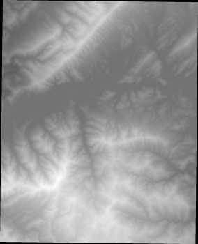
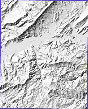
| Here is a Digital Elevation Map (DEM). A DEM is a file containing one altitude/elevation per pixel. Currently, 30 meter / pixel and 10 meter / pixel scales are available. The ones used here are 30 meter. | Here is a render of the same DEM with hillshading (3D relief). The hillshade done here is typical of what is available in Cartographic software. | |
 |
 . . |
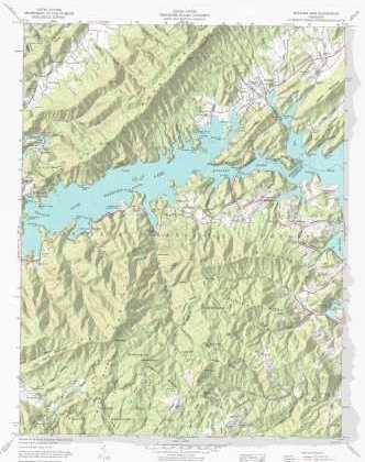
The DEM is used as a height field and a version of the topo with the white collar clipped is used as pigment for the DEM. A full version of the topo (with color) is used as pigment for a plane. The result is the plane intersects the height field in such a way as to give the illusion that there is only one topo, one where the collar is flat but the map area is 3D. This is why you will notice shadows cast on the right side of the map collar. Note the two versions are not quite the same scale. |
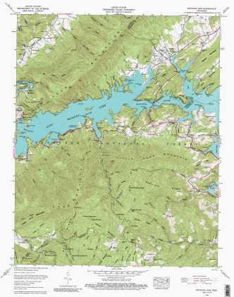
| This is a scanned topo without CGI special effects. |
Here is a render of the same topo with CGI. |
|
 |
 |
|