CGI and Maps
The application of CGI to the production of maps.
In the course of making maps, I realized I could incorporate some of my CGI experience into my technique. I am familiar with the popular freeware CGI rendering engine, PoV-Ray and decided to use the CGI engine instead of the proprietary Cartographic software's script equivalent. The basis for this is a CGI renderer will do more than add 3D to the map. The illusion of reality is enhanced by the use of radiosity, media, and photon mapping, all CGI techniques. The images below are about 65% resample of an 1/8 scale rendered image. |
 . . |
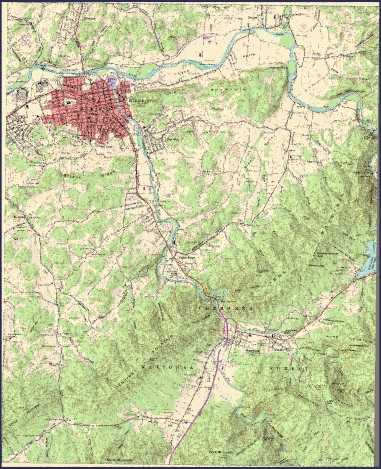 |
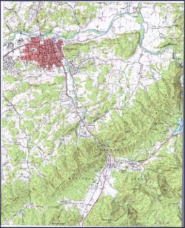
| A topo with the usual white background and CGI applied. The map "collar", or margin, has been removed. | Here is a render of the same topo with a buff/tan background. The tan/buff background makes extended on-screen viewing easier on the eyes. |
|
One other project I enjoyed was constructing an animated GIF which begins with a plain topo, and proceeds with the surface rising into the map, morphing the flat map into a 3-dimensional surface with the topo overlaid. In the renderer, the DEM surface begins below the topo and rises, projecting the topo onto the DEM with each new positioning of the DEM. Visualize two light sources. The first is the Sun casting shadows on the DEM, the second is a slide, or movie, projector projecting the image of a topo map onto the DEM simultaneously.Below you see the beginning and ending images side by side. The images were scaled to 1/16th before animating. |
| Start Frame : The map margins are off-white because the map is reproduced in a rendering environment in which sunlight and atmosphere are simulated by radiosity and photon mapping in PoV-Ray.. 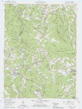 |
; | End Frame : At the right and bottom edges can be seen the shadow cast by the painted DEM surface overlaying the unclipped version of the topo image painted on a plane. 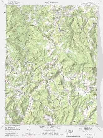 |
ANIMATIONS
DETAILS
MORE DETAILS